

The latest Three Lane Highway news and reviews
Cycling Toward a Cooler Toronto | The Power of Bike Lanes
Reflection on Berkeley’s Bike Lane Drama
Hopkins bike lanes get approved for at least a third time. The drama won’t stop here.
Dissecting Doug Ford’s Bike Lane Removal Annoucement
A blog about cycling and political advocacy based in Toronto, Canada. (#BikeTO)

Three Day Road
Three Day Road is the first novel from Canadian writer Joseph Boyden. Joseph's maternal grandfather, as well as an uncle on his father's side, served as soldiers during the First World War, and Boyden draws upon a wealth of family narratives. This novel follows the journey of two young Cree men, Xavier and Elijah, who volunteer for that war and become snipers during the conflict. The book was generally critically well received.

Motorists in one of a Montreal’s busiest boroughs support bike lanes
There are real tensions between cyclists, motorists and pedestrians sharing the road, but Montrealers believe traffic-calming measures — bike lanes, speed humps and curb extensions — can improve safety for all road users.

Three.js Roadmap — Learn WebGL/WebGPU Development | Three.js Roadmap
Learn WebGL/WebGPU development with Three.js through structured video courses and ready-to-use assets. Build stunning 3D games, visualizations, and interactive web experiences.

Streets are made for talking: so that's what we did - Bridges For Communities
We’ve been trying something new at Bridges. Popping up on high streets and town centres in Bristol to talk to people about community life and the issues that are impacting […]

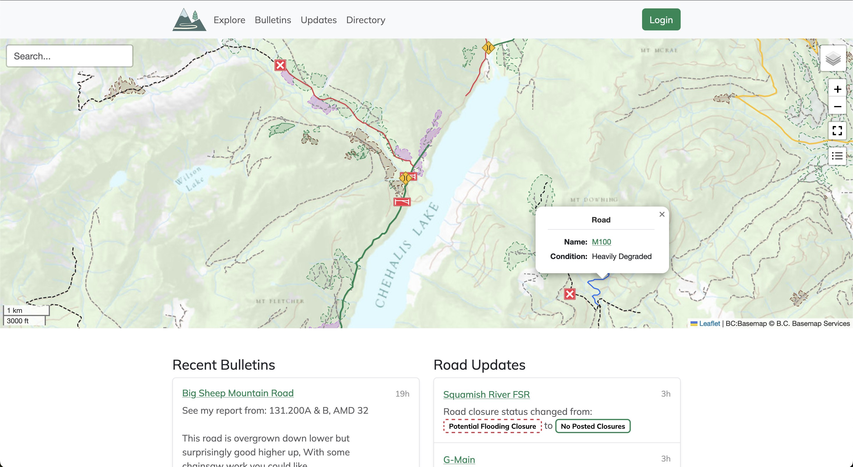
Service Road Atlas
Service roads are an integral part of accessing the wilderness, but they're constantly changing over time. Use the Service Road Atlas to find the latest community driven updates on the roads you wish to access.
Building Roundabout: A Pro-Social Platform for Local Communities
A conversation with the team behind New_ Public's Roundabout.

Roundabout
Roundabout is your new online community for local life. Find what you need, connect with neighbors, and take pride in your community.

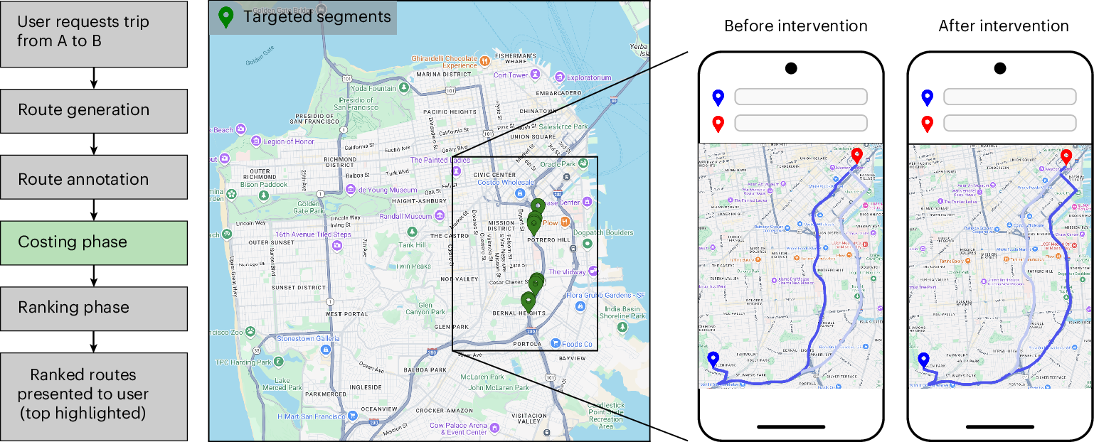
Urban congestion relief experiments through routing-app interventions
Traffic congestion remains a persistent challenge for urban mobility, increasing travel delays and elevating CO2 emissions. The widespread use of smartphones and GPS navigation creates new opportunities to mitigate congestion through routing optimizations in apps, yet real-world evidence for the effectiveness of such interventions is limited. Here we report large-scale empirical experiments evaluating routing-based traffic interventions on ~100 highly congested road segments across 10 major US cities. By rerouting a small share of Google Maps trips from targeted congested highway and arterial segments to less congested alternatives of equivalent road-classes with comparable travel times, we observe a city-average 2% increase in vehicle speeds on the intervened segments, along with improved travel times 0.7% and potential annual reductions exceeding 1,000 tons of CO2-equivalent emissions per city in the majority of studied locations. These findings provide evidence that marginal routing interventions involving a small proportion of vehicles can measurably enhance overall road network efficiency, offering a practical pathway to easing congestion and advancing urban sustainability.
Rivian R3: Electric Crossover
Discover the future of urban exploration with the Rivian R3 — an all-new electric crossover built for bold adventures in the city and beyond.

Taking imagery of bike lanes in Toronto: 60,000 photos later…
Imagery Update After a summer and fall of taking 360 imagery of bike lanes, I finished capturing street-level imagery of all the protected bike lanes in the City’s dataset. The last segment on November 8 was the final part of the new Harbord St bike lanes E of Grace St. So far, I’ve captured over…
Yohan on Twitter / X
For six months, Google Maps sent a slice of drivers in ten American cities down deliberately slower routes.About 30 seconds slower on average, and under 2% of trips were touched. The experiment ran on roughly 100 of the most congested road segments in each city, switching on… pic.twitter.com/5cshNdmWU2— Yohan (@yohaniddawela) August 28, 2026

Taking imagery of bike lanes at risk and using it to help fix bike parking
We took street-level imagery on Bloor St, Yonge St, University Ave, Queen’s Park Cres, and Avenue Rd to create a digital record of bike lanes at risk from Ontario Bill 212 and to help analyze…

RoadSketch — draw a line, find the road