The Richat Structure, or Guelb er Richât, often called the Eye of Africa is a prominent circular geological feature at the northwestern edge of the Taoudeni Basin, on the Adrar Plateau of the Sahara. It is located near Ouadane in the Adrar Region of Mauritania. In Hassaniya Arabic, rīšāt means feathers and it is also known locally in Arabic as tagense, referring to the circular opening of the leather pouch that is used to draw water from local wells.
Adinkra Symbols of West Africa
An illustrated guide to the African symbols called Adinkra used in Ghana, West Africa, with an adinkra index and high-quality adinkra images.
Habeas Flight Watch — National Map
Western Ghats
The Western Ghats, also known as the Sahyadri, is a mountain range that stretches 1,600 km (1,000 mi) along the west coast of India. Covering an area of 160,000 km2 (62,000 mi2), it traverses the Indian states of Gujarat, Maharashtra, Goa, Karnataka, Kerala, and Tamil Nadu. The range forms an almost continuous chain of mountains along the western edge of the Deccan Plateau, from the Tapti River to Swamithoppe in Kanyakumari district at the southern tip of the Indian peninsula. The Western Ghats meet with the Eastern Ghats at Nilgiris before continuing south.

Venus of Tan-Tan
The Venus of Tan-Tan is an alleged artifact found in Morocco. It and its contemporary, the Venus of Berekhat Ram, have been claimed as the earliest representations of the human form.


Photos-Miracle in the desert: Entire, intact ancient city hidden in Egypt uncovered - Egypt Independent
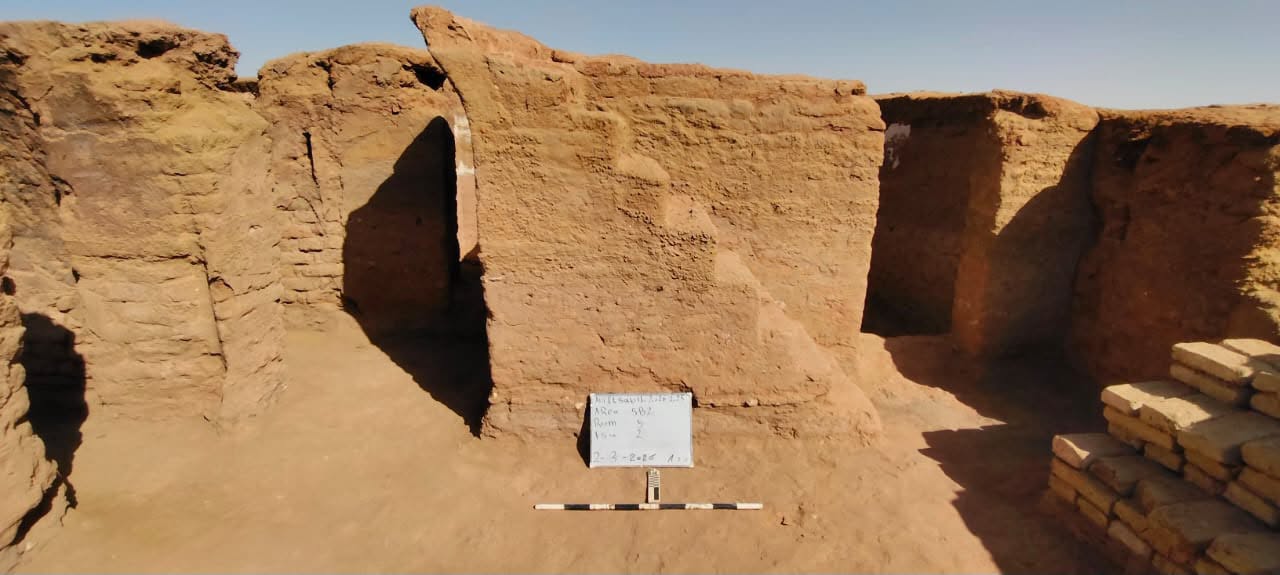
Deep within Egypt’s Western Desert, the sands of the Dakhla Oasis have just surrendered a remarkably preserved secret. An Egyptian archaeological mission has discovered an entire, intact residential city dating back to the Byzantine era. Constructed entirely of mud brick at the Ain El-Sabeel site, the sprawling settlement offers a rare, cinematic window into what …
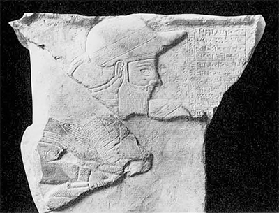
Expedition Magazine | Aspects of Elamite Art and Archaeology
In Sumerian texts we read about the country NIM, the wondrous mountain area which we call Iran today. The biblical […]
Mineral Water Atlas of the World
[V5] National map — Habeas Flight Watch
African religions and philosophy
"A Doubleday Anchor book."; Includes indexes; Bibliography: p. [364]-371; Mode of access: Internet

Weaponised Skies: The Expansion of Terrorist Drone Use Across Africa
Jama’at Nusrat al Islam wa al Muslimeen (JNIM) in Mali and Burkina Faso

salish see — a living atlas of the Salish Sea
Explore the watersheds, communities and ideas shaping the Salish Sea — and connect with the people doing the work.