

We describe a method for computing signed distance to point clouds that allows fast pointwise evaluation at arbitrary spatial resolution. As input, our method takes a point cloud with normals; as output, it provides an analytical parameterization that allows queries of signed distance to the approximate underlying surface at arbitrary points — simultaneously providing reconstruction and distance. Our key idea is to reconstruct shapes by locally fitting point clouds with tori, which have closed-form signed distance functions. Tori are fitted in a feed-forward manner, using a pre-trained network to output per-point curvature and shift parameters. Importantly, our method does not require costly global optimization or spatial discretization, and is easily parallelizable. Underlying our method is a new theory that unifies signed distance with the classic reconstruction methods of winding numbers and Poisson surface reconstruction. We use our method to compute signed distance to point clouds arising from photogrammetry, meshes, 3D Gaussians, and neural implicits. Our method allows point clouds to be used directly in applications, without explicit surface reconstruction: as examples, we take offsets of point clouds, apply morphological and Boolean operations, and directly visualize offset surfaces using sphere tracing.
Nicole Feng
We introduce a method for approximating the signed distance function (SDF) of geometry corrupted by holes, noise, or self-intersections. The method implicitly defines a completed version of the shape, rather than explicitly repairing the given input. Our starting point is a modified version of the heat method for geodesic distance, which diffuses normal vectors rather than a scalar distribution. This formulation provides robustness akin to generalized winding numbers (GWN), but provides distance function rather than just an inside/outside classification. Our formulation also offers several features not common to classic distance algorithms, such as the ability to simultaneously fit multiple level sets, a notion of distance for geometry that does not topologically bound any region, and the ability to mix and match signed and unsigned distance. The method can be applied in any dimension and to any spatial discretization, including triangle meshes, tet meshes, point clouds, polygonal meshes, voxelized surfaces, and regular grids. We evaluate the method on several challenging examples, implementing normal offsets and other morphological operations directly on imperfect curve and surface data. In many cases we also obtain an inside/outside classification dramatically more robust than the one obtained provided by GWN.
Discontinuity-Aware 2D Neural Fields
Neural image representations offer the possibility of high fidelity, compact storage, and resolution-independent accuracy, providing an attractive alternative to traditional pixel- and grid-based representations. However, coordinate neural networks fail to capture discontinuities present in the image and tend to blur across them; we aim to address this challenge. In many cases, such as rendered images, vector graphics, diffusion curves, or solutions to partial differential equations, the locations of the discontinuities are known. We take those locations as input, represented as linear, quadratic, or cubic \bez curves, and construct a feature field that is discontinuous across these locations and smooth everywhere else. Finally, we use a shallow multi-layer perceptron to decode the features into the signal value. To construct the feature field, we develop a new data structure based on a curved triangular mesh, with features stored on the vertices and on a subset of the edges that are marked as discontinuous. We show that our method can be used to compress a 100,000^2-pixel rendered image into a 25MB file; can be used as a new diffusion-curve solver by combining with Monte-Carlo-based methods or directly supervised by the diffusion-curve energy; or can be used for compressing 2D physics simulation data.
Evaluating and Sampling Glinty NDFs in Constant Time
Geometric features between the micro and macro scales produce an expressive family of visual effects grouped under the term 'glints'. Efficiently rendering these effects amounts to finding the highlights caused by the geometry under each pixel. To allow for fast rendering, we represent our faceted geometry as a 4D point process on an implicit multiscale grid, designed to efficiently find the facets most likely to cause a highlight. The facets' normals are generated to match a given micro-facet normal distribution such as Trowbridge-Reitz (GGX) or Beckmann, to which our model converges under increasing surface area. Our method is simple to implement, memory-and-precomputation-free, allows for importance sampling and covers a wide range of different appearances such as anisotropic as well as individually colored particles. We provide a base implementation as a standalone fragment shader.
Pixal3D: Pixel-Aligned 3D Generation from Images
Recent advances in 3D generative models have rapidly improved image-to-3D synthesis quality, enabling higher-resolution geometry and more realistic appearance. Yet fidelity, which measures pixel-level faithfulness of the generated 3D asset to the input image, still remains a central bottleneck. We argue this stems from an implicit 2D-3D correspondence issue: most 3D-native generators synthesize shape in canonical space and inject image cues via attention, leaving pixel-to-3D associations ambiguous. To tackle this issue, we draw inspiration from 3D reconstruction and propose Pixal3D, a pixel-aligned 3D generation paradigm for high-fidelity 3D asset creation from images. Instead of generating in a canonical pose, Pixal3D directly generates 3D in a pixel-aligned way, consistent with the input view. To enable this, we introduce a pixel back-projection conditioning scheme that explicitly lifts multi-scale image features into a 3D feature volume, establishing direct pixel-to-3D correspondence without ambiguity. We show that Pixal3D is not only scalable and capable of producing high-quality 3D assets, but also substantially improves fidelity, approaching the fidelity level of reconstruction. Furthermore, Pixal3D naturally extends to multi-view generation by aggregating back-projected feature volumes across views. Finally, we show pixel-aligned generation benefits scene synthesis, and present a modular pipeline that produces high-fidelity, object-separated 3D scenes from images. Pixal3D for the first time demonstrates 3D-native pixel-aligned generation at scale, and provides a new inspiring way towards high-fidelity 3D generation of object or scene from single or multi-view images. Project page: https://ldyang694.github.io/projects/pixal3d/

Fast calculation of the distance to cubic Bezier curves on the GPU
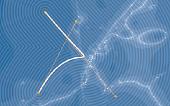
Bézier curves are a core building block of text and 2D shapes rendering. There are several approaches to rendering them, but one especially challenging problem, both mathematically and technically, is computing the distance to a Bézier curve. For quadratic curves (one control point), this is fairly accessible, but for cubic (two control points) we're going to see why it is so hard.
Signed Distance Fields – Render Diagrams
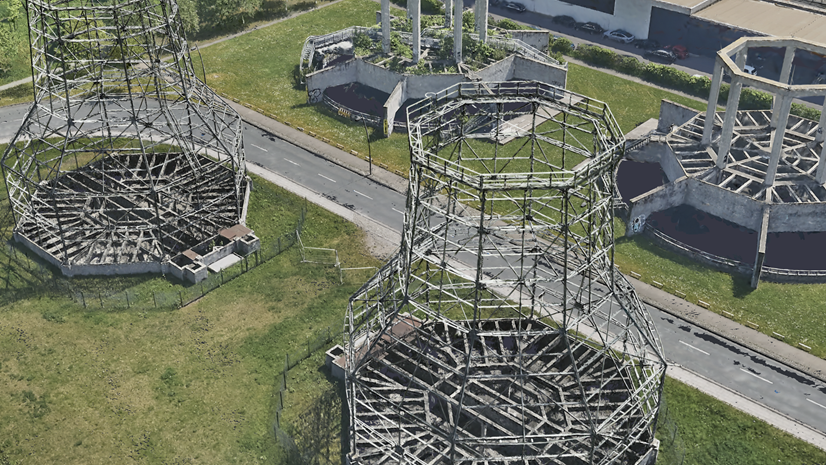
Meshes vs. Gaussian Splats: Which reality representation should you choose?
Learn the differences between meshes and Gaussian splats, how each represents reality, where they excel, and why the most effective reality mapping workflows increasingly leverage both.
RoboScape: Physics-informed Embodied World Model
World models have become indispensable tools for embodied intelligence, serving as powerful simulators capable of generating realistic robotic videos while addressing critical data scarcity challenges. However, current embodied world models exhibit limited physical awareness, particularly in modeling 3D geometry and motion dynamics, resulting in unrealistic video generation for contact-rich robotic scenarios. In this paper, we present RoboScape, a unified physics-informed world model that jointly learns RGB video generation and physics knowledge within an integrated framework. We introduce two key physics-informed joint training tasks: temporal depth prediction that enhances 3D geometric consistency in video rendering, and keypoint dynamics learning that implicitly encodes physical properties (e.g., object shape and material characteristics) while improving complex motion modeling. Extensive experiments demonstrate that RoboScape generates videos with superior visual fidelity and physical plausibility across diverse robotic scenarios. We further validate its practical utility through downstream applications including robotic policy training with generated data and policy evaluation. Our work provides new insights for building efficient physics-informed world models to advance embodied intelligence research. The code is available at: https://github.com/tsinghua-fib-lab/RoboScape.
SAVA: Scalable Learning-Agnostic Data Valuation
Selecting data for training machine learning models is crucial since large, web-scraped, real datasets contain noisy artifacts that affect the quality and relevance of individual data points. These noisy artifacts will impact model performance. We formulate this problem as a data valuation task, assigning a value to data points in the training set according to how similar or dissimilar they are to a clean and curated validation set. Recently, *LAVA* (Just et al., 2023) demonstrated the use of optimal transport (OT) between a large noisy training dataset and a clean validation set, to value training data efficiently, without the dependency on model performance. However, the *LAVA* algorithm requires the entire dataset as an input, this limits its application to larger datasets. Inspired by the scalability of stochastic (gradient) approaches which carry out computations on *batches* of data points instead of the entire dataset, we analogously propose *SAVA*, a scalable variant of *LAVA* with its computation on batches of data points. Intuitively, *SAVA* follows the same scheme as *LAVA* which leverages the hierarchically defined OT for data valuation. However, while *LAVA* processes the whole dataset, *SAVA* divides the dataset into batches of data points, and carries out the OT problem computation on those batches. Moreover, our theoretical derivations on the trade-off of using entropic regularization for OT problems include refinements of prior work. We perform extensive experiments, to demonstrate that *SAVA* can scale to large datasets with millions of data points and does not trade off data valuation performance. Our Github repository is available at \url{https://github.com/skezle/sava}.
atmoprints - 3D Models on AT Protocol
A decentralized 3D model hosting platform built on AT Protocol. Share, discover, and download 3D printable models on the open social web.
Shared Geometry As A Rosetta Stone: Cross-Modal Alignment Without Paired Data
Multimodal representations enable zero-shot classification and retrieval, but aligning independently trained models usually requires large amounts of paired data. Yet, the Platonic Representation Hypothesis suggests that models trained on different modalities may converge spontaneously toward a shared representation geometry. But then, do we even need paired examples for cross-modal alignment? Remarkably, we show that paired examples are unnecessary for coarse cross-modal alignment. Our simple Wasserstein Procrustes method with a coarse geometric initialization aligns two disjoint embedding sets by estimating a single orthogonal map without seeing any pairs. Across datasets, modalities, and unimodal models, we show that we can consistently align independently trained representations without pairs, and standard geometric alignment metrics accurately predict when this is possible. Nevertheless, we can naturally benefit from paired examples. In the very few-pair regime, our method substantially outperforms existing ones, while staying competitive with pair-based methods with more added examples. Finally, we demonstrate that the resulting alignments can enable text-to-image generation without paired examples. These results show that independently trained models often share enough geometry to establish cross-modal correspondence with little or no paired data.
Problems of geometry, sampling, and scale in gridded biodiversity data, and proposed solutions
Grids, and gridded biodiversity data such as regional or country-level atlases, play a prominent role in ecology, particularly in the study of spatial patterns of species occupancy, geographic ranges, biodiversity, and their drivers and temporal dynamics. However, managing, exploring, and analyzing data in grids comes with problems. Here, we review the problems with gridded data, and the existing solutions. We focus on grid-specific problems of sampling (e.g. varying sampling method and effort in space and time, imperfect detection), geometry (e.g. varying grid cell area and shape, positional errors), and scale (e.g. spatial grain and temporal extent). A first group of solutions can be implemented prior to gridding of the data. This includes the selection of an appropriate geographic projection, grid grain, and grid cell shape. The second type of solution involves the manipulation and processing of the gridded data. Examples include aggregating cells to coarser grains or removing cells that fail to meet certain quality criteria. The third type of solution is implemented during the analysis of the data. The most important is the quantification of the problem for use in statistical models or machine learning algorithms as a covariate. We hope to provide guidance particularly to early-career ecologists who may otherwise struggle to make sense of the various solutions scattered through the literature.
Event Cameras: a New Way of Sensing - Davide Scaramuzza - ICCP 2024 Keynote
Efficient Task-Specific Data Valuation for Nearest Neighbor Algorithms