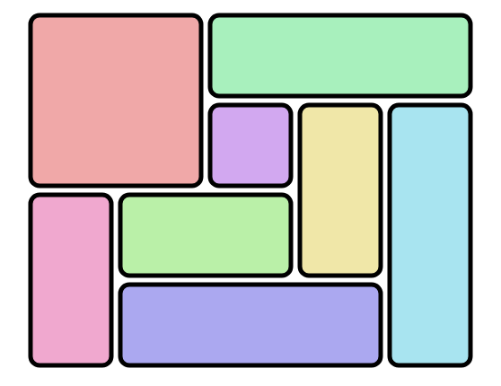
Last week, I saw a talk on Vuntra City, a procedurally generated city with a fully explorable city. Developer Larissa Davidova explained that she settled on using Recursive Subdivision for the city…
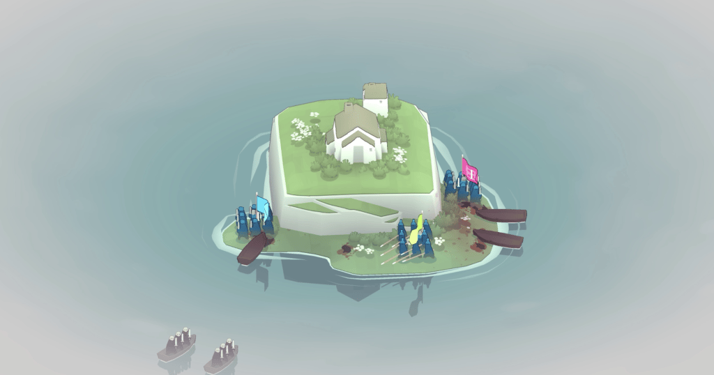
How Townscaper Works: A Story Four Games in the Making
Townscaper, the procedural town-building toy, has been a huge indie success story. I explain how the game can generate towns so easier and gain further insights thanks to my interviewing its creator Oskar Stalberg.
A City for Children — Oakland Public Library
A City for Children — Gutman, Marta, — American cities are constantly being built and rebuilt, resulting in ever-changing skylines and neighborhoods. While the dynamic urban landscapes of New York, Boston, and Chicago have been widely studied, there is much to be gleaned from West Coast cities, especially in California, where the migration boom at the end of the nineteenth century permanently changed the urban fabric of these newly diverse, plural metropolises. In A City for Children Marta Gutman focuses on the use and reuse of everyday buildings in Oakland, California, to make the city a better place for children. She introduces us to the women who were determined to mitigate the burdens placed on working-class families by an indifferent industrial capitalist economy. Often without the financial means to build from scratch, women did not tend to conceive of urban land as a blank slate to be wiped clean for development. Gutman shows how, over and over, women instead turned private houses and even a saloon in Oakland into orphanages, kindergartens, settlement houses, and day care centers, and in the process built the charitable landscape--a network of places that was critical for the betterment of children, families, and public life. The industrial landscape of Oakland, riddled with the effects of social inequality and racial prejudice, is not a neutral backdrop in Gutman's story but an active player. Spanning one hundred years of history, A City for Children provides a compelling model for building urban institutions, and it demonstrates that children, women, charity, and reform, along with incremental construction, renovations, alterations, additions, and repurposed structures, are central to the understanding of modern cities.
National Zoning Atlas
The National Zoning Atlas is digitizing, demystifying, and democratizing information about zoning conditions in more than 33,000 jurisdictions in the U.S. — empowering advocates, revealing insights, and driving research.

Game Design Perspective: Stardew Valley — Pixelated Playgrounds
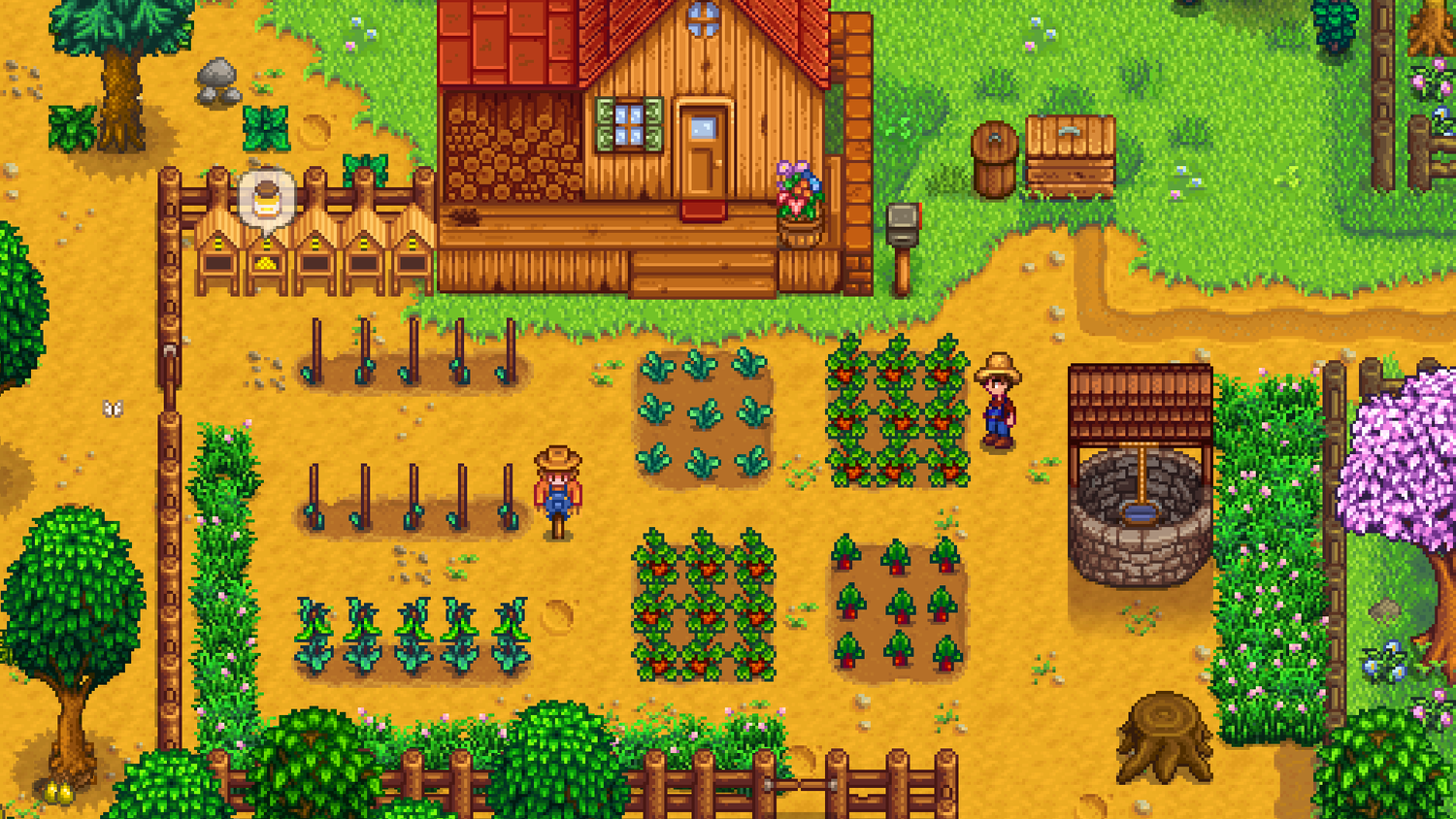
Recently, Juliana has gotten into Stardew Valley. Hard. Since I’m a huge fan myself, I'm doing a Game Design Perspective on the game to celebrate. I'll be looking at the game mechanics and how the interlocking layers make the game tick. In Stardew Valley, you play as a disillusioned city slicker wh
Network science reveals the structure and lasting impact of the Roman road system
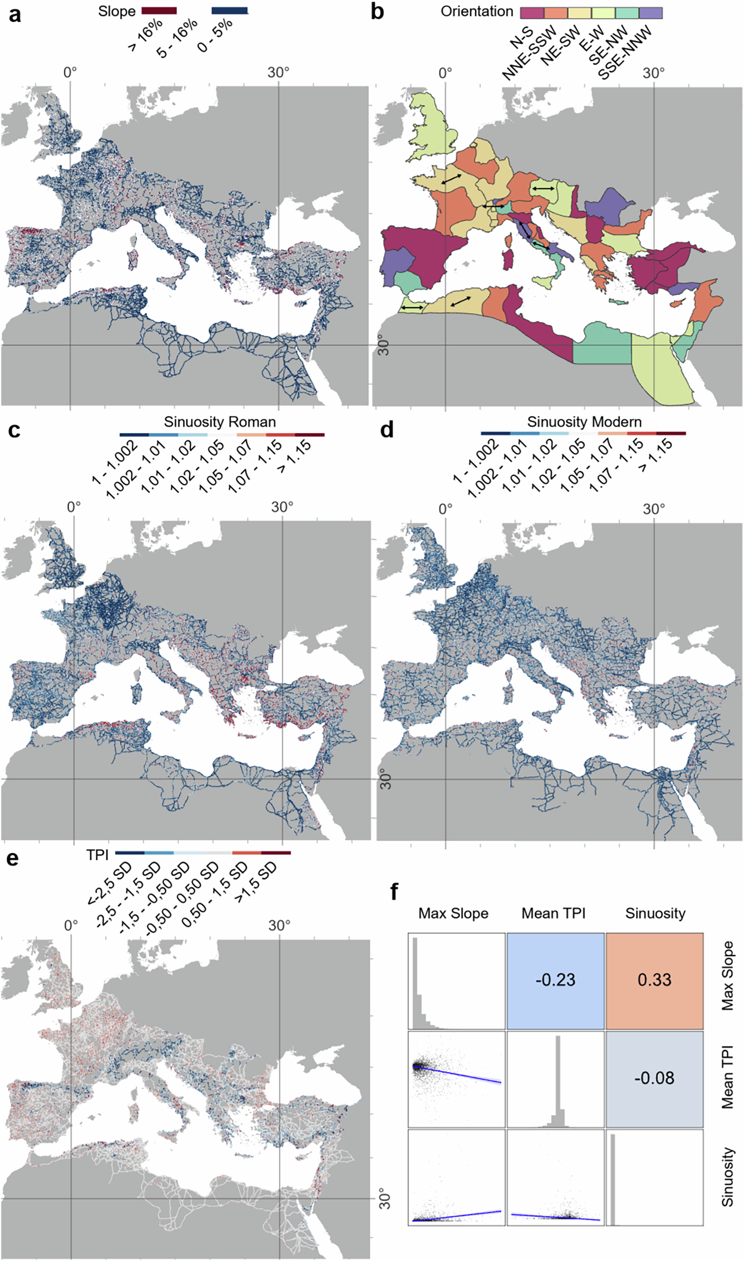
Ancient infrastructure can leave lasting imprints on modern settlement patterns and mobility. The Roman road network connected vast regions of Europe, North Africa, and the Middle East, and is often mentioned as an example of such long-term impact. Yet its structural characteristics remain largely unquantified. Here we present a high spatial resolution quantitative exploratory analysis of the Roman Empire’s road system, enabled by our creation of a spatially detailed Empire-wide dataset. We address long-standing questions concerning the straightness and persistence of these roads, and the centrality of cities like Rome. We show that Roman roads tend to be straight where topography allows but less so than modern roads; provincial capitals were more centrally located than other cities for mediating terrestrial mobility; segments hypothesised to be main roads were more important intermediaries than secondary roads; and Roman road density correlates with major modern roads.
Metagov Short Talks (June 14, 2023) : Metagovernance Seminar
Nick Kaufmann and Matt Crittenden present Spectra: the virtual city that builds real cities, a talk discussing how to combine multi-scale cooperative...

A City Is Not a Computer: Other Urban Intelligences
<strong>A bold reassessment of "smart cities" that reveals what is lost when we conceive of our urban spaces as computers</strong> Computational models of urbanism—smart cities that use data-driven planning and algorithmic administration—promise to deliver new urban efficiencies and conveniences. Yet these models limit our understanding of what we can know about a city. <i>A City Is Not a Computer</i> reveals how cities encompass myriad forms of local and indigenous intelligences and knowledge institutions, arguing that these resources are a vital supplement and corrective to increasingly prevalent algorithmic models. Shannon Mattern begins by examining the ethical and ontological implications of urban technologies and computational models, discussing how they shape and in many cases profoundly limit our engagement with cities. She looks at the methods and underlying assumptions of data-driven urbanism, and demonstrates how the "city-as-computer" metaphor, which undergirds much of today's urban policy and design, reduces place-based knowledge to information processing. Mattern then imagines how we might sustain institutions and infrastructures that constitute more diverse, open, inclusive urban forms. She shows how the public library functions as a steward of urban intelligence, and describes the scales of upkeep needed to sustain a city's many moving parts, from spinning hard drives to bridge repairs. Incorporating insights from urban studies, data science, and media and information studies, <i>A City Is Not a Computer</i> offers a visionary new approach to urban planning and design.
Procedural river or road generation for infinite terrain
I should say paths, not roads as I'm thinking more medieval-like. Also, not looking for realism. The answer I'm looking for will be to fit into the mold I describe rather than realism. I am lookin...


Planning for isolation? The role of urban form and function in shaping mobility in Brasilia
Brasília offers a rare test of how urban form shapes experienced segregation. Built almost at once around modernist neighbourhood units, then expanded through planned satellites and informal peripheries, it lets us ask whether urban form turns mobility into mixing or into a more efficient engine of separation. We combine data on human mobility with urban morphometrics, amenities, road networks, along with enclosures and tessellations that capture segregation at the scales where access is structured: districts, neighbourhoods, blocks, and street-and-building cells. We find that segregation intensifies as resolution sharpens, from 0.282 at the district scale to 0.545 at the block scale, indicating that Brasília looks most integrated at coarse units and most segregated where everyday encounters are actually organised. Mobility softens home segregation for most users, but not symmetrically: poorer groups travel farther, while affluent groups remain the most selectively exposed. civic cores and mid-rise, mixed-use areas are the least segregated morphotypes, yet they occupy only a sliver of the metropolis. Elsewhere, rich lakefront suburbs and dense poor settlements reach similarly high segregation through opposite spatial logics. Amenities predict lower segregation, while barriers and enclosed residential interiors predict higher segregation. Built form explains more of this pattern than visit volume alone in the segregation models: integration is less a property of residential design than of shared destinations and porous connections. Planned capitals can build order without building isolation if they distribute mixing space rather than sequestering it.

Citybound as a Truly Moddable and Educational Simulation
How I discovered the technique of domain-specific languages to achieve faster development, make modding much more approachable and offer an entry-point into programming itself.

Cozy Kingdoms Generation
Cozy Kingdoms is the marriage of a procedural map generation method, a really good tileset, and a name generation algorithm. It looks a bit ...

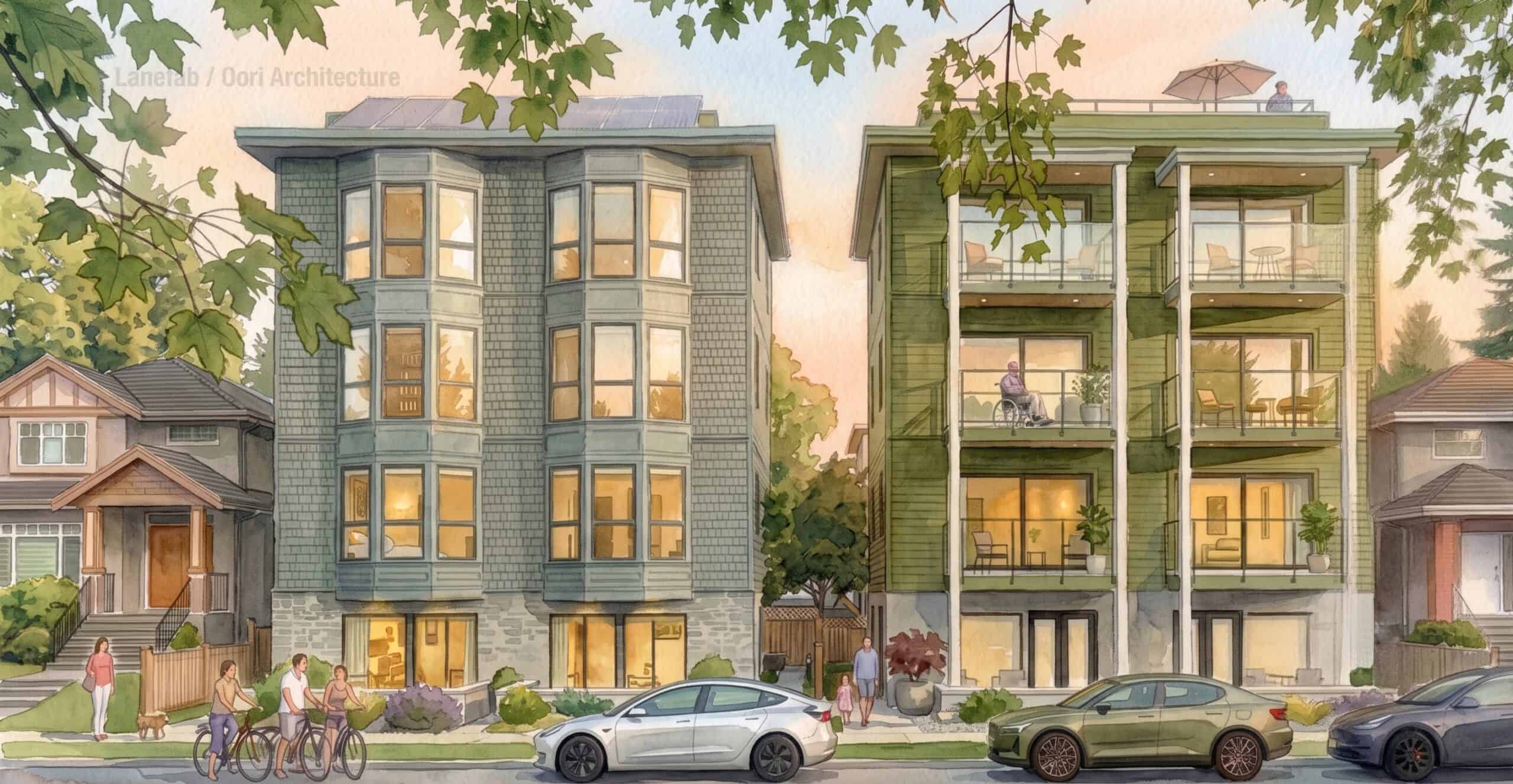
In Pictures: The Possibilities of Vancouver’s New Villages Plan | Sightline Institute
The Four/Five design prioritizes green space, daylight, affordability, and accessibility—all for greater connection and community.