


A faraway island in Alaska has had its share of visitors, but none can remain for long on its shores.
The Republic of Cows | Hakai Magazine
When habitat loss is one of the biggest issues facing wild animals, why has Alaska given an entire uninhabited, remote island to feral cattle?

Ahupuaʻa — an island from mountain to sea
A Hawaiian high island divided mauka to makai into ahupuaʻa, with a guided tour of ancient Hawaiian life and a simulated island weather system.
Hawaii’s Beaches Are Disappearing
Major islands have lost nearly a quarter of their beaches in the last century. The culprit? Seawalls and other barriers erected by wealthy homeowners.

Houthis seize 2 strategic Red Sea islands, and other Mideast developments
This move strengthens their control over a key maritime shipping route.

Denmark and Greenland say US military agreement will not compromise Arctic territory’s sovereignty
Statement sought to clarify Trump’s announcement that US will have ‘permanent control’ over Greenland’s security

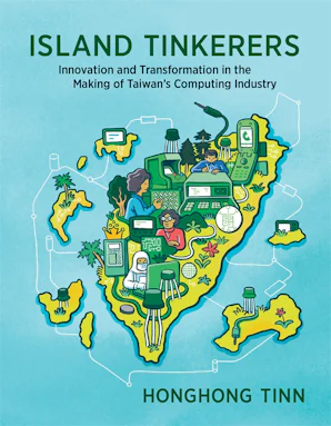
Island Tinkerers
How did Taiwan, a former Japanese colony and the last fortress of the defeated Chinese Nationalists, ascend to such heights in high-tech manufacturing? In Is...
https://aneeshsathe.com/the-viscous-frontier/
In May 1976 a Satawalese master navigator named Mau Piailug stood on the deck of a double-hulled Polynesian canoe in Honolua Bay, Maui, and prepared to sail to Tahiti. Sans compass, chronometer, and chart. The canoe was Hōkūleʻa, a replica of the voyaging craft that had carried Polynesians across the Pacific a thousand years earlier. Over the next thirty-four days Piailug would navigate her about two thousand three hundred nautical miles south-southeast to Papeete using the rising and setting positions of stars, the shape of ocean swells refracted off islands beyond the horizon, the colour of the water at dusk, and the behaviour of terns returning to land at evening.
Chronology and ecology of early islanders in the Philippines: The Mindoro Archaeology Project
The investigation and excavation of caves and rockshelters located at the southern end of Occidental Mindoro produced significant artefacts, data, and information related to the initial arrival and colonization of the Philippine archipelago by anatomically modern humans. The sites provided several indications for the increasing adaptation to maritime environments and delivered evidence for their behavioural and technological complexity. Mindoro lies along a direct route to reach the main islands of the Philippines coming from the Asian mainland via Borneo and Palawan. Since 2010, surveys conducted in the karstic regions of Ilin Island and Sta. Teresa, Magsaysay have mapped and explored over 40 caves and rockshelters. Particularly the sites of Bubog 1, Bubog 2, Cansubong 2 Cave, and Bilat Cave, have delivered cultural and biological materials that chronicle human habitation and adaptation to maritime and coastal environments over a period of 35–40,000 years. Early islanders in the region intensively foraged for molluscs and other marine invertebrates along the coast, employed different techniques to catch a variety of reef and pelagic fish as well as terrestrial animals, and were embedded in maritime networks with access to transfer routes, through which technology, information, and ideologies were disseminated over long distances and across Island Southeast Asia (ISEA) and possibly also reaching the Southeast Asian mainland. The results of the archaeological research in Mindoro contribute to our understanding of the processes of human island adaptation, complement ongoing research on the peopling of Southeast Asia, and enhance current knowledge of prehistoric subsistence strategies across the region.
The Map Is Not the Territory
The map is not the territory reminds us that our mental models of the world are not the same as the world itself. It cautions against confusing our abstractions and representations with the complex, ever-shifting reality they aim to describe.

Island | The enterprise platform for AI, network, and data protection
Island is the ideal environment for enterprise work, where modern business requirements like enterprise AI, secure access, and data protection are built into the workplace itself — so organizations can finally stop choosing between enabling their workforce and protecting their data.

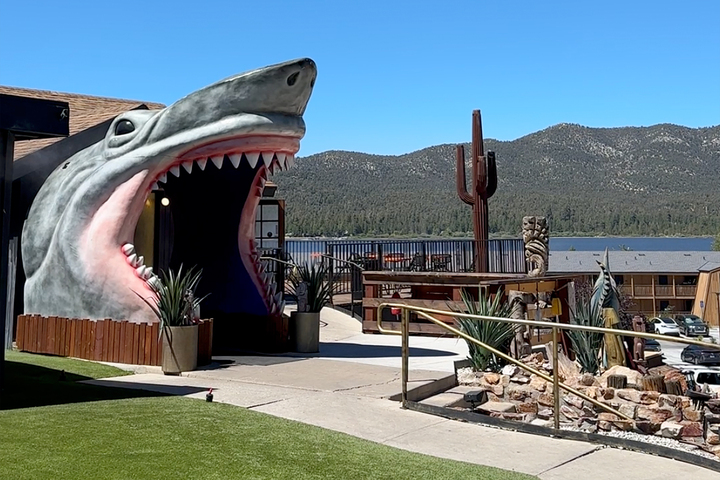
America's best poke is in a tiny Calif. mountain town, not Hawaii
A sunny day with the giant lakeside shark.
Peaches
On a faraway island in another place and time entirely, a young man yearns for more.
Confronting Data Centers, Deep-Sea Cables, and Colonial Legacies in the South Pacific - Data & Society
Tropical paradise. Smiling faces. This is the fantasy Fiji has successfully sold to the world. And as I drive along the West Coast of Viti Levu, the archipelago’s largest island, the scenery does indeed resemble a tourist advertisement: crystal-blue ocean water, white sandy beaches, and lush tropical forests hugging the shoreline. But Fiji is more than breathtaking landscapes. While most people are aware of the rapid rise of data centers in the US and Europe, the creeping influence of tech giants like Google and Starklink can be seen and felt here, too.

@semble.so find island by url
With appreciation for to @werd.io's foundational work on identifying the archipelagos and @tessa.germnetwork.com -- whose recent Leaflets on the future of social media are quite inspiring!

Everyone Fled the Feed for the Group Chat.
inputs-outputs.leaflet.pub🌏 East Asia and the Pacific Islands

East Asia (CJKM + ASEAN) + Pacific Islands (Micronesia, Polynesia, Melanesia)
수랕 이나와 (Surat Inawa) — a Filipino phonetic alphabet adapted from the original scientific script of King Sejong
수랕 이나와 (Surat Inawa)
수랕 이나와 (Surat Inawa)
수랕 이나와 (Surat Inawa) — a Filipino phonetic alphabet adapted from the original scientific script of King Sejong
수랕 이나와 (Surat Inawa)

수랕 이나와 (Surat Inawa)

