

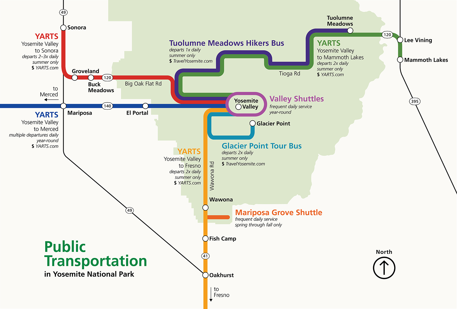
Traffic in Yosemite National Park - Yosemite National Park (U.S. National Park Service)
Official websites use .govA .gov website belongs to an official government organization in the United States.
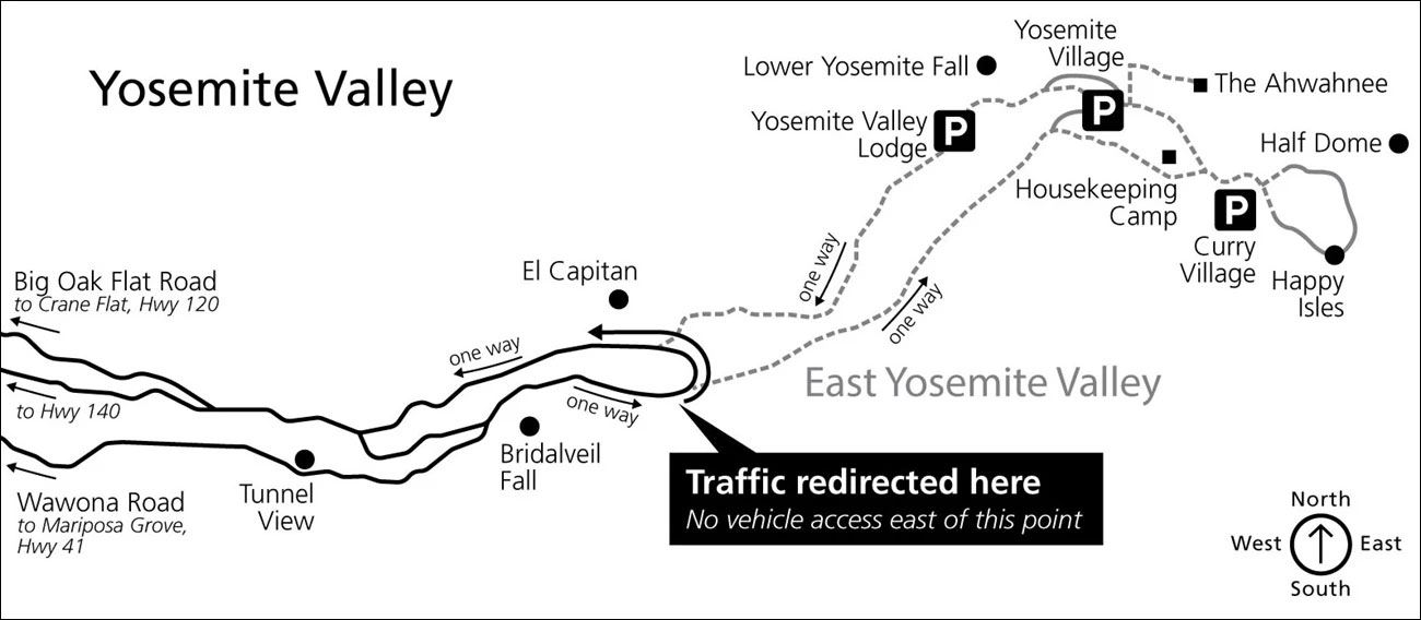
Yosemite Area Regional Transportation System

Yosemite Bike Share Program (U.S. National Park Service)
Official websites use .govA .gov website belongs to an official government organization in the United States.
Once-in-a-year ride in Yosemite on Tioga Pass Road (updated 2024)
Bicycling on opening day- pictures, itinerary, and planning tips

National Park Service: Public Use of the National Park System (1872-2000): Chapter 9
The first part of this section reviews basic ideas for dispersing visitors outside the System. While merit is seen in some of these ideas, the conclusion is reached that at best they can make only a limited contribution to regulating mounting park travel because there is no substitute for a visit to a national park. The second part of this section then reviews concepts and methods for regulating public use inside the parks through park developments, land classification, including wilderness area designations, and vehicular controls, including new transportation systems.
Hiking by Transit
Transit-accessible hikes, parks, and trailheads across California.
Designing a wayfinding concept for Vancouver's Skytrain system.
I wasn’t always a big fan of public transport.

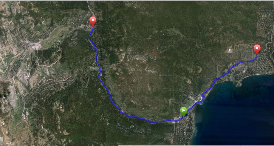
Historic Truckee River Bike Path
Historic Truckee River Bike Path Ride Details Challenge: A level bike ride. Caution needed with the presence of many users: pedestrians, baby strollers, joggers, pets on leashes, river rafters, and […]

Ode to the Shanghai Metro - Phoebe Lemon
Wayfinding has many applications, and arguably the most important one is public transportation systems. Granted, there are many different ways to design such a system, and the politics and culture of the environment in which it will be integrated certainly plays a large role. Interestingly, often when we discuss transportation systems on the global scale, individuals are so quick to praise New York or London’s metro systems, Europe’s “high speed” rail system, or how “Uber is the most original new technology cities have seen”. All of these statements are subjective, but somehow they’ve become accepted fact, especially in the West, and I argue that anyone who gives European/American public transport that much praise is blissfully living in a bubble. As an international student who grew up in America and has visited most of its major cities, lived in China for two years, and is now studying in the Middle East, I’ve had the opportunity to use almost every public transportation system to exist. Old fashion taxis, the Maglev, high speed trains, shared bikes, shared mopeds, carpools, the bus, the metro, I have used them all, but nothing quite compares to the way China does public transport.

Renewable Energy and National Security
The wind and the sun don’t need to transit the Strait of Hormuz

Download OpenStreetMap for Northern California | Geofabrik Download Server
Download OpenStreetMap data for Northern California for self-hosting or data analysis. OSM PBF and Shapefiles available.

Taking imagery of bike lanes at risk and using it to help fix bike parking
We took street-level imagery on Bloor St, Yonge St, University Ave, Queen’s Park Cres, and Avenue Rd to create a digital record of bike lanes at risk from Ontario Bill 212 and to help analyze…

About Grin - About Us
Based in Vancouver BC, Canada, we are a team of electric bike enthusiasts eager to change the face of modern transportation...

Biidaasige Park expansion
The portion of Biidaasige Park west of Cherry Street opened this weekend. Had to see if for myself. It was great to see plenty of people walking and biking about to check it out. Here is a view of …

Google Takes on Uber With New Ride-Share Service
Google is moving onto Uber’s turf with its own ride-sharing service in San Francisco that would help commuters carpool at far cheaper rates, according to a person familiar with the matter, jumping into a booming but fiercely competitive market.
